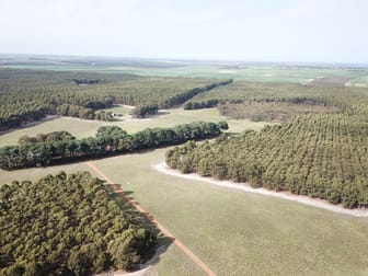
"Wilga Bank" is situated on the east side of Coxall Road, with the eastern boundary running alongside the Oldfield River.
"Wilga Bank" is approximately 26 kms south-west of Munglinup, 80 kms east south-east of Ravensthorpe, 130 kms west of the regional centre of Esperance, and 12 kms north of the Munglinup Beach caravan park.
The property consists of two adjoining free hold titles, with a combined total area of 1601 hectares.
"Wilga Bank" was originally developed for sheep grazing. Shelter belts where integrated into the landscape to help lift productivity of both stock and annual pasture. The selection of tree species centred around pioneering a potential dual-purpose tree: one that offered shelter and with some future commercial timber value.
The land is gently undulating with natural drainage into the Oldfield River. There is a diverse range of soils, ranging from sandy duplex, with some deeper sands and shallower types over lateritic gravel and clay. The diversity in soil types reveals a broad range of flowering native vegetation which adds to the biodiversity of the property.
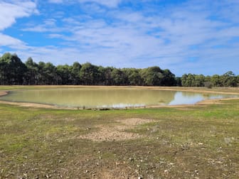
Water is supplied from dams, soaks and bores. Average rainfall is around 525 mmm per annum.
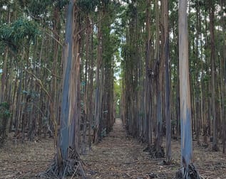
Current land use consists of 1015 hectares of mature blue gums planted in 2001. 45 hectares of maritime pine, 184 hectares cleared for agriculture, and 357 hectares of native vegetation.
The aged Infrastructure is typical of the era and original sheep grazing enterprise, with homestead, general purpose shed, machinery shed, and shearing shed with yards. Horizon power is currently converting the power supply to a standalone unit, which will provide stability in supply.
"Wilga Bank" is centrally located while close to the southern coast. The topography and proximity to the Oldfield River makes the property quite unique, and the land capability offers future diversification.
"Wilga Bank" is being sold by Expressions of Interest, to be submitted by the close of business on Friday the 25th of August 2023.